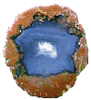
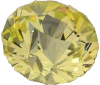
The cabochon is Oregon Sunset jasper from the Richardson Ranch in central Oregon. It's easily the best piece I've ever had and one of my top ten favorite cabs :)
The cabochon is Oregon Sunset jasper from the Richardson Ranch in central Oregon. It's easily the best piece I've ever had and one of my top ten favorite cabs :)
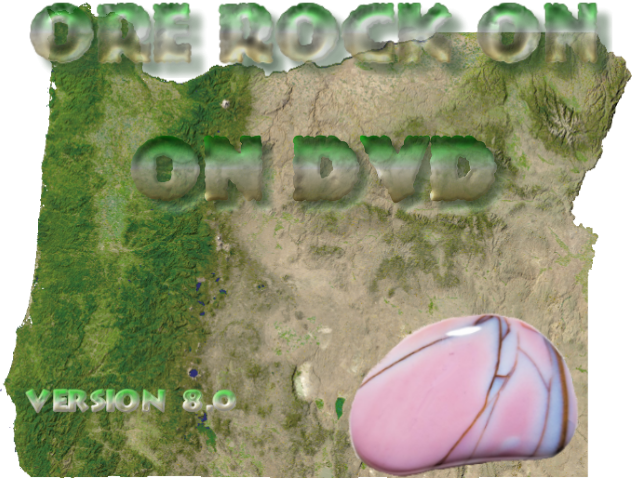
 ROCKHOUNDING, MINERAL, AND FOSSIL COLLECTING LOCATIONS DDVD VERSION 8
($10 for Version 7 DVD, I have a limited supply left - email me!)
36 site writeups with details on what you'll find, digging tips, and photos of the sites and the booty :)
2,500-ish (I gave up counting!) photos of dig sites, rocks, minerals, fossils, scenic views, critters, (and a couple dirty rockhounds!)
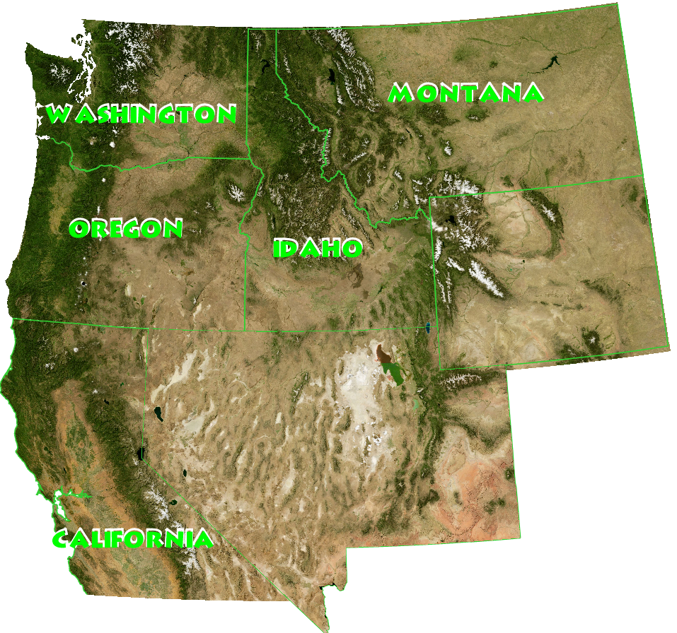
Locations include ALL sites with rock, mineral, or fossil collecting opportunities in these 8 recently published (and awesome) books:
Gem Trails of Oregon by Garret Romaine. 175 waypoints on 105 topo maps for 93 of 99 sites in the book that have rockhounding opportunities.
Gem Trails of Washington First and Second editions by Garret Romaine. Second edition. Between the two editions there are now 267 waypoints on 141 topo maps for 72 of 80 sites in the first edition and 95 of 100 sites in the second edition that have rockhounding opportunities.
Gem Trails of Idaho & Western Montana by Lanny Ream. 132 waypoints on 93 topo maps for 93 of 99 sites in the book that have rockhounding opportunities.
Rockhounding Washington by Lars Johnson 115 waypoints on 87 topo maps for ALL 74 sites in the book.
Gem Trails of Northern California by Garret Romaine 231 waypoints on 105 topo maps for 89 of 97 sites in the book that have rockhounding opportunities.
Rockhounding Montana by Montana Hodges 99 waypoints on 66 topo maps for 91 of 100 sites in the book that have rockhounding opportunities.
That's a total of 739 sites and 1,423 waypoints folks! If you have any of the books the DVD will be an immense help in actually getting to sites and have other nearby sites and more waypoints for many of them. If you have the DVD then purchasing the books for the states you’re interested in is strongly encouraged, I leave it up to the authors to give details for sites I didn’t already have.
Repeat customers get 30% off any new purchase!
A DVD disc which will work in any DVD drive (PC, laptops, external USB, Mac (all flavors of iOs except for very old systems which are probably all in landfills). Works on all Windows and MAC devices, and most mobile devices. Ask if you aren’t sure, if you device has a DVD drive, USB port or SD card slot it’s a simple setup. There are instructions for those devices that don’t have any of these.
A USB thumb drive that will work in any device than can read a thumb drive
A Micro SD card for any devices that have an SD card reader. If your phone has a SD slot it will work! I can help with instaling on most phones without a slot. An adaptor is included for a full size Micro SD card slot.
An FTP ZIP folder download for any device that can unzip it (mobile devices may require a ZIP app).
You can stick the MicroSD right into your Smartphone! One more thing, if your device has no way to attach anything to it, find one that does, upload it to your favorite cloud, and download from there. It won't become an "app" unless you can find a volunteer to put a month or so into developing one, or for trade in rocks of course :)
IMPORTANT ! If you choose the download version I will give a link to the FTP folder containing the DVD ZIP file, login instructions and a one-time-use password. You MUST know how to use FTP on your device. If you don't know if it will work then you need to research the procedure for yourself. On any Windows or Mac device clicking on the link in the email should always work. I have further instructions on how to download the contents in the email. Once you tell me you've downloaded it then I will reset the password. So save the folder somewhere that you won't lose it and make sure you're able to find it again! You have to be able to open ZIP files on your device. The ZIP file 2061 megabytes = 2 gigabytes. So also make sure you have that much storage space on your device first!
ATTENTION MicroSD CARD CUSTOMERS: I have learned that at some point that Android in their infinite wisdom has stopped supporting SD cards formatted the way I have been using since the beginning of time itself. Probably with Android version 7.1. So IF THE CARD NO LONGER WORKS IN YOUR DEVICE EMAIL ME AND I'LL SEND A FREE REPLACEMENT! The current cards should work on an Android device.
Current DVD owners: If you have purchased ANY version of the CD or DVD from me in the past then you can get the DVD Version 8 for a 30% discount (before shipping, USB and SD card extra)! CONTACT ME HERE
Order DVD Version 8 |
Tips on Using the DVD |
Please note: If you read the entire contents of this page, and then email me asking a question that is already answered on this page, be prepared for the wrath of the rock gods to come down and cast a blight upon your entire household! Also: If you have a question about "where to go rockhounding" or "where is the best place for (fill in the blank)" (I get these at least once a week), I'll just refer you to the DVD, that's what it's for! There are online sources for the Pacific Northwest if all you want is a place or two to try out rockhounding or fossil/mineral collecting so I suggest you Google them... or better yet join your local rock club!
The DVD contains all the rock digs I have visited, plus many, many more, complete with topo maps, directions, and example photos of the rocks, minerals, or fossils available at each site with a write-up (and many others). There are so many sites on the DVD that you can't possibly visit them all unless you have a couple decades of summers to spare! Sites that I haven't personally checked out or have first-hand knowledge of are great places to explore, who knows, maybe you'll be the first to discover something new or rediscover something lost! The DVD also contains files for viewing each waypoint in Google Earth and a waypoint list for downloading to just about any GPS unit (you need to have the software and cable for your GPS unit, or you can easily enter them by hand). I may provide updates of the waypoint file if you have supplied me with a valid email address. It contains full descriptions of 29 productive rockhounding areas in Oregon and 7 areas in Washington (some Idaho sites are included in the Oregon area write-ups). Also example photos of hundreds of materials available at sites that are not included in the detailed write-ups, many of which are from the actual site. I make no guarantees about the accuracy of the landowner information. Contacting landowners and finding out what the various state and federal rules for rock digging are is your responsibility!
Please note: This is it for a while, I have covered what I wanted to cover ever since the first edition 20 years ago (and lots more!). I'm giving it a couple years, if I'm not satisfied with sales by then I'll be calling it quits. There is a SMALL chance that I mgiht tweak an FTP version integrating a couple books that aren't on V8, and that I already have sites for. There are a copule more books in the works, if any of them overlap the areas I already have I might integrate them as well.

PLEASE READ BEFORE ORDERING: The DVD will NOT work in a video DVD player! You MUST have a DVD drive on your computer to view the DVD. If you only have a CD drive, you need to install a DVD drive; they are CHEAP. I paid $33 for the world's fastest DVD Writer drive in Noc. 2019, I bet they're practically giving away read only drives now, so there is no excuse not to buy one! THE DVD WORKS ON ALL NEW MACS. It definitely works on older MAC operating systems, except very old ones. IT WORKS ON ALL WINDOWS BASED PCs, indeed, any OS that supports WWW browsing including Ipads, tablet PCs, Android phones, Iphones, and all sorts of other gadgets. All you need is a web browser and a DVD drive, USB port, or SD card slot. I highly recommend that you have the latest version of your browser installed!
![]()
 Tips on using the CVD/DVD (corrected internet links and errata are here)
S&H: Media Mail $5.50, Priority Mail $11.00, First Class Canada about $18.00
![]()
 Lapidary Materials, Faceting Rough, Fossils, and More for Sale
 Lapidary Equipment Restoration Services
Lapidary Arts Instruction Classes
 Rock Cutting and Polishing Services
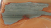 Polished Rock Slabs & Pieces for Sale
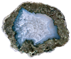
 Polished Agates for Sale
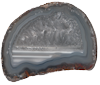
 Polished Thundereggs for Sale
 Faceted Gemstones for sale
 Cabochons for Sale
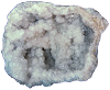 Rock Crystal Geodes for Sale
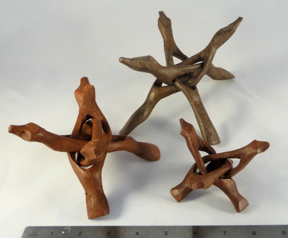 Rock Display Stands for Sale
 Rock & Lapidary Bookstore
 Ore-Rock-On Rockhound and Lapidary Supply Store
 Back to
Ore-Rock-On!
Back to
Ore-Rock-On!![]()
Copyright © 1997 - 2026
Tim FisherUsers may download this World Wide Web page for personal use only. Unauthorized copying or distribution of this page or any of its contents without the express permission of the author is expressly forbidden.